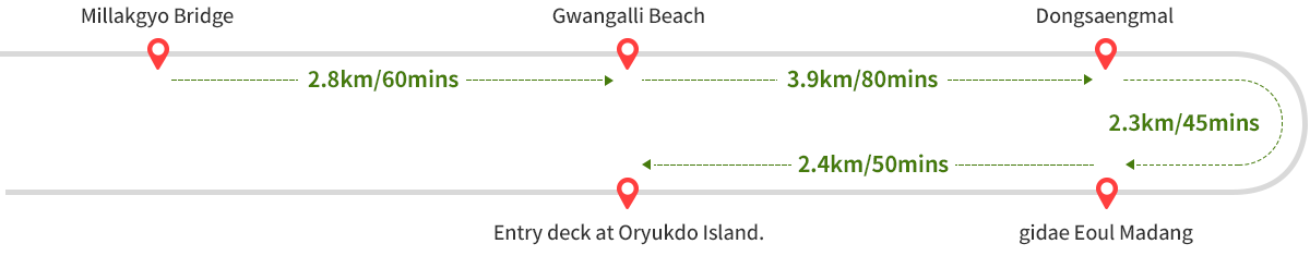
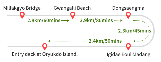
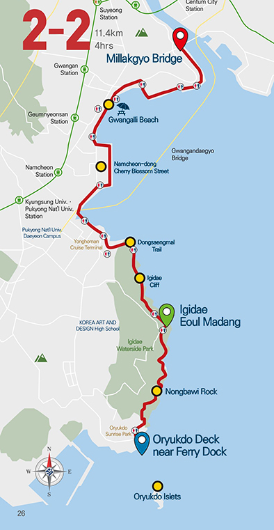
Route 2-2: Millakgyo Bridge ~ Entry deck at Oryukdo Island.
 Starting
point
Starting
point Finishing point
Route 2-2
Total Distance: 11.4km, Total Time: 4hrs, Difficulty: Moderate
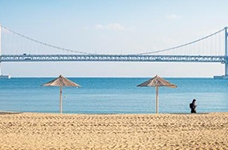
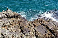
When trekkers cross Bunpo, which the salt field was in, at the end of the night view of Gwangandaegyo Bridge across the sea, a new sea opens and the magnificent coastal scenery of Igidae welcomes them at every corner. The intrepidity of Chimabawi Rock, waves surging between Bakgolsae, and the view towards Oryukdo Islets from Nongbawi Rock are the essence of Igidae. Beyond Sataegol, Oryukdo Islets, Scenic Site No. 24, approaches on the horizon. The Oryukdo Islets stand in the order of Bangpaeseom Island, Solseom Island, Suriseom Island, Songgotseom Island, Gulseom Island, Deungdaeseom Island (Batseom Island) from the land, and they are called Oryukdo Islets because Bangpaeseom Island and Solseom Island are seen as one island at low tide and as two islands at high tide, appearing as either five or six islets. It is the junction of the South Sea and the East Sea.