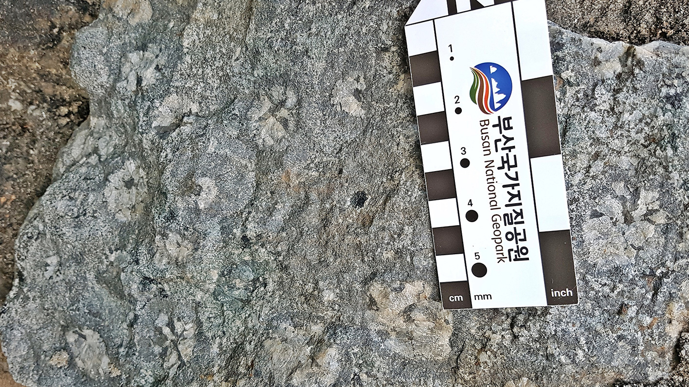
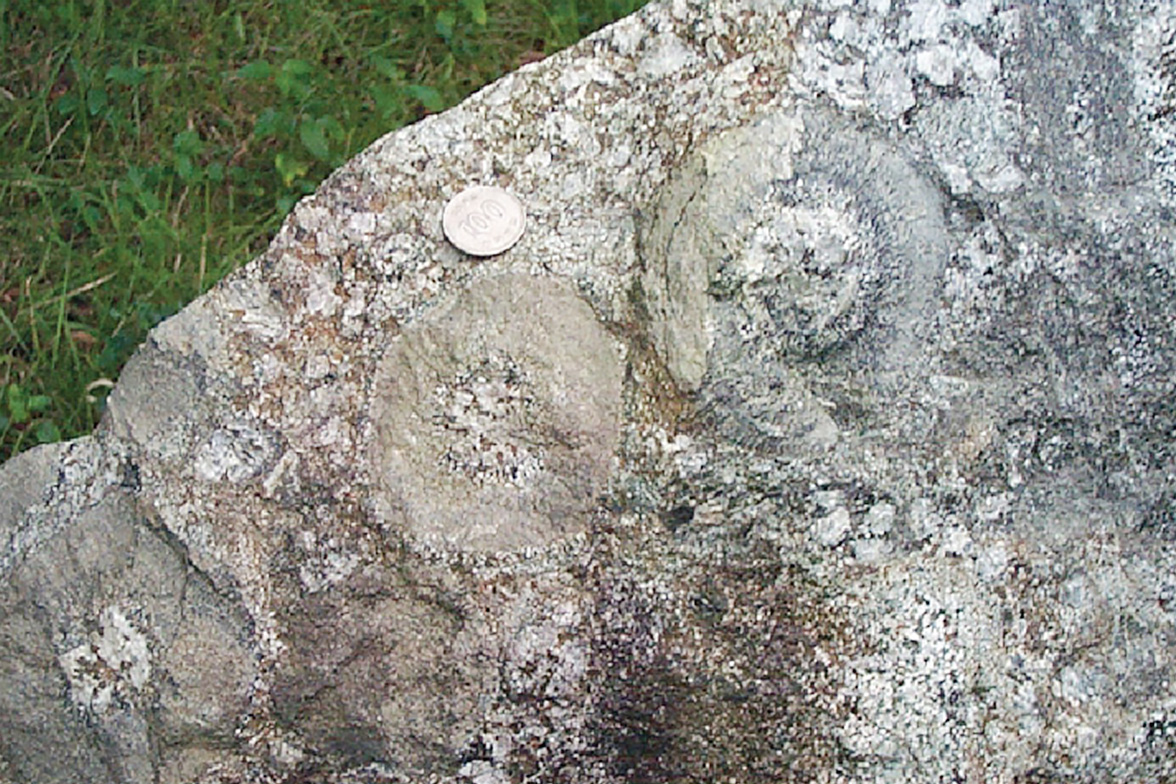
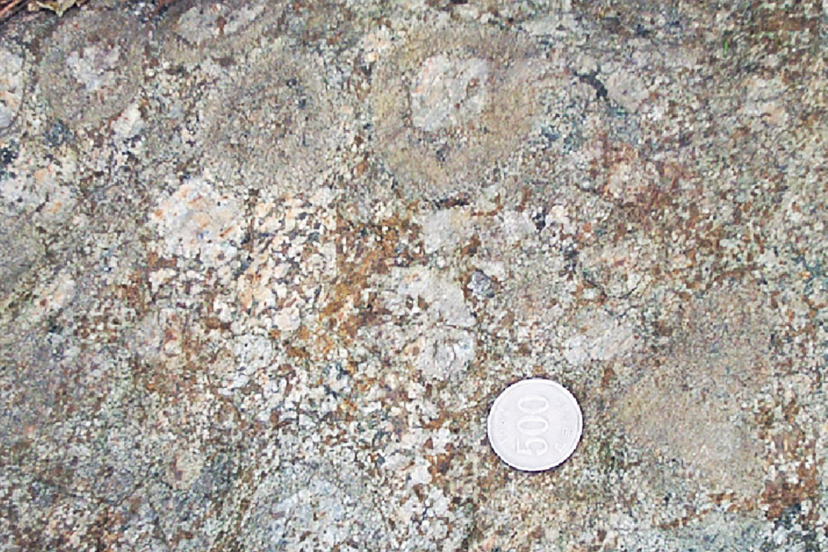
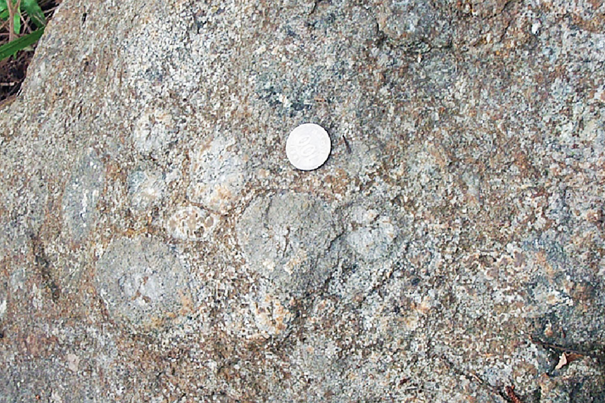
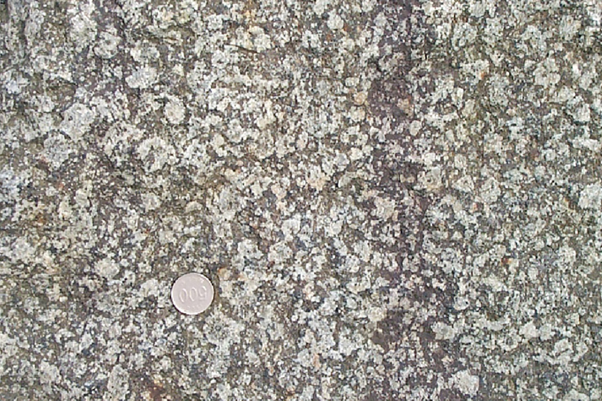
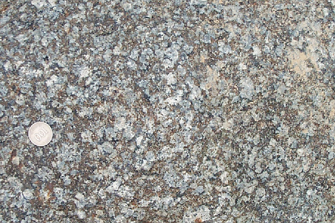
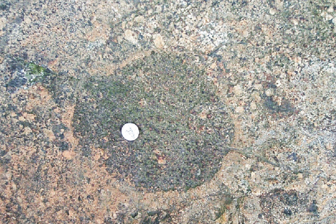
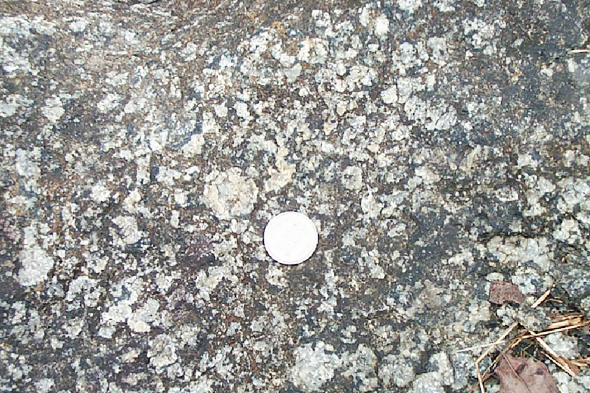
Orbicular Gabbro around Hwangnyeongsan Mountain, rock made by magma slowly hardening deep underground about 60 million years ago, has a surface of orbicular texture on which minerals are arranged in concentric circle shapes around the core.
Gabbro is a rare rock, hard to find in Korea. Orbicular Gabbro holds high academic value, having been reported as one of a kind in Asia and rare in the world. It is Busan Geopark’s top attraction, designated Natural Monument No. 267.
Name and history
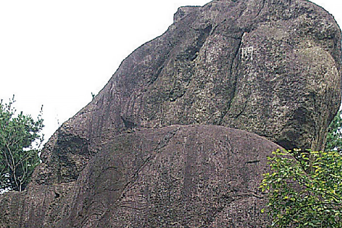
Orbicular Gabbro distributed halfway up Hwangnyeongsan Mountain is a rock group and an important material for researching how the earth formed. Orbicular Gabbro, exceedingly rare all over the world, has been found in 14 locations in eight countries, with Hwangnyeongsan Mountain being the first found in the East. The name Hwangnyeongsan, where Orbicular Gabbro is located, seems to originate from Geochilsan-guk (kingdom) that existed in the old Dongnae area. Geochilsan is the Korean expression of “rugged mountain” in idu script. It is interpreted that the place name Hwangnyeongsan results from using its meaning and Chinese characters. In 1422 (7th year of King Sejong’s reign), beacon fire stations, an important means of military communication, were installed on the tops of mountains in Dongnae-bu (town).
These beacon fire stations were connected to others in Ganbiosan Mountain in Haeundae in the east, Gubong in the west and Beomeosa and Gyemyeongsan in the north.
Tourist information
Mt.Hwangnyeongsan
Hwangnyeongsan Mountain with Orbicular Gabbro at its foot, located at the center of Busan Metropolitan City, is a 428-meter mountain with beacon fire stations at the top, bordering Busanjin-gu, Nam-gu, Suyeong-gu and Yeonje-gu.
The exposed part (outcrop) of Orbicular Gabbro, the world’s largest in area, serves as a material of worldwide importance not only for formation of the plate tectonics theory, but also for research on the cause of rock creation.
Jangsan Festival (mountain trail open to the public only once a year)
Traditional mountain festival held every October
The summit of Jangsan Mountain, normally a military camp with restricted access, is open for the festival.
Visitors can enjoy the mountain festival declaration, recitation of announcement to heaven, folk song performance, Daedong Nori (festival of performers and audience), Teobalgi (ritual of treading on the ground) and Korean folk band performance.
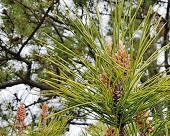
Representative vegetation
Gomsol (Black pine tree)
Gomsol, an evergreen needleleaf tree belonging to Pinaceae genus, usually grows on the seashore with some growing further inland along rivers. Golsol, meaning black pine tree, is also called Haesong (Antipathes japonica) because it grows along the seashore.
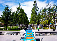
A 473,000㎡ urban park located in downtown Seomyeon, Busan. The large park, used as Seomyeon Racecourse during the Japanese colonial era, is where the US military camp Hialeah was stationed after the Liberation.
After the military base was closed in 2006, a civic park was constructed and opened in 2014 on the back of citizen demand. Busan Citizens Park offers various park facilities organized under five activity themes of memory, culture, joy, nature and participation.
051) 850-6000
Metro Line
Walk 10 minutes from exit 7 of Bujeon Station on Metro line 1.
Walk 15 minutes from exit 4 of Buam Station on Metro line 2.
Intra-city bus No. 33, 44, 54, 63, 81, 83-1, 88, 103, 133 and 179 → Get off at “Busan Citizens Park,” “Busanjin-gu Office” or “Buam intersection.
Directions
Private car/rental car
By Gyeongbu Highway
Route 7 – Geumjeong-ro (250m) → Turn left at highway entrance toward Geumjeong-gu Office (4.7km) → Naeseong Underpass City Hall direction (2.3km) → in 2 o’clock direction at Yeonsan intersection toward City Hall (980m) → Turn left in front of City Hall toward Yeonje-gu Office (440m) → Turn right at Yeonje-gu Office three-way intersection toward Yangjeong intersection (530m) → Turn left on Yangjeong-ro (230m) → Turn right toward Dong-Eui Institute of Technology (1.1km) → Park on campus and walk
By Namhae Expressway
Naengjeong JC → Namhae Expressway branch line2 (18.5km) → Dongseo Elevated Bridge Urban Expressway, exit in Jurye (Hadan) direction (1.7km) → Gamjeon IC Gamjeon Ramp direction (1.5km) → Hakjang Ramp direction (1.8km)→ Gaya-daero (4.3km) → in 10 o’clock direction at Seomyeon intersection toward City Hall and National Police Agency (800m) → Turn right at Samjeon intersection toward Munhyeon intersection (570m) → Dong-Eui Institute of Technology direction
Subway/ bus
Intra-city bus
No. 5-1, 20, 57, 62, 86, 87, 99,110-1, 141 and 1010 → Get off at “Yangjeong” bus stop → Transfer to mini bus
Mini bus
Busanjin-gu No. 7 → Get off at “Dong-Eui Institute of Technology” → Walk 5 minutes toward soccer field
Busanjin-gu No. 11, 12 → Get off at “Dongeui Middle School” → Walk 10 minutes toward soccer field in Dong-Eui Institute of Technology
Subway
Take exit 2 of Yangjeong Station on Metro line 1 → Transfer to mini bus (Busanjin-gu No. 7)
Information on tourist attractions
Song Sanghyeon Square
A 34,740㎡ square, located on Jungang-daero (central road) extending from Seomyeon, Busan toward Busan City Hall, comprises three Madangs (yard): Culture Madang, Dynamic Busan Madang and History Madang. Culture Madang, equipped with an outdoor stage and cafes, is for performances and events; Dynamic Busan Madang, a lawn square, is for street celebrations and festivals; History Madang is equipped with a ground fountain and the Forest of History. It was named Song Sanghyeon Square to honor Dongnae Magistrate Song Sanghyeon who resisted with determination the Japanese Invasion of Korea in 1592.
051) 605-4095
Walk 3 minutes from exit 8 of Bujeon Station on Metro line 1.
Intra-city bus No. 5-1, 20, 57, 62, 86, 87, 99, 110-1, 141 and 1010 → Get off at “Song Sanghyeon Square” or “Songgong three-way intersection.”