Service hours
- Summer Apr.∼ Sept. (6 months) 05:00 ∼ 20:00
- Winter Oct.∼Mar. (6 months) 06:00 ∼ 18:00
- ※ Mmilitary units control the area outside of service hours and at night.
- Inquiry : 051)209-2000
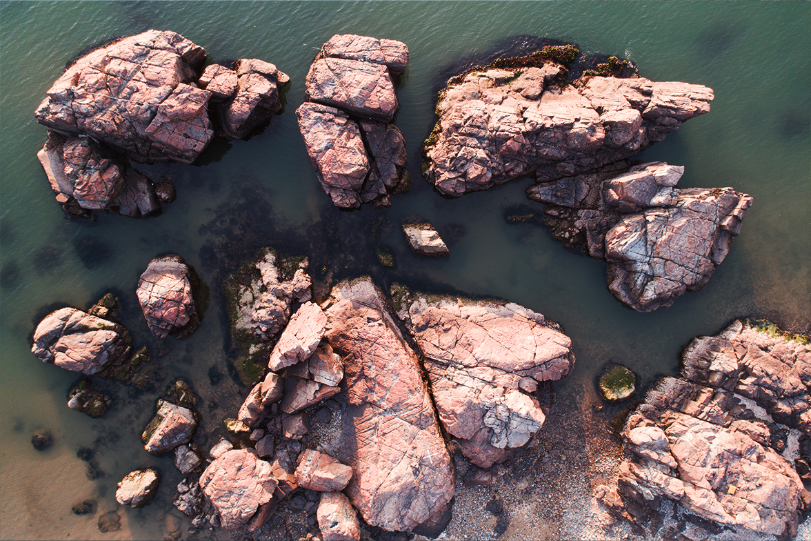
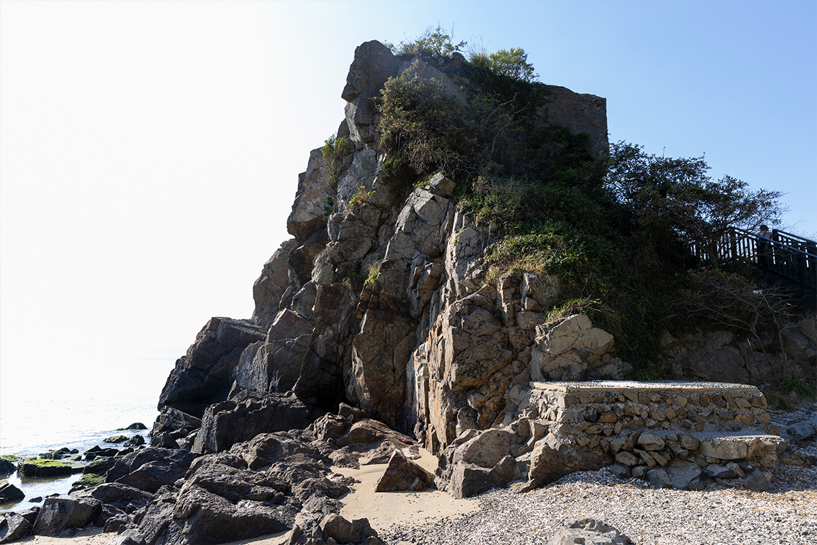
Attraction providing a glimpse into Lower Dadaepo Formation, deposited during the late Cretaceous period about 80 million years ago and the crustal deformation process in the Busan area after that.
It used to be an island called “Morundo,” then evolved into a land-tied island with unique terrain thanks to built-up sand from Nakdonggang River.,
It is an attraction that can be dubbed the textbook of geology with its variety of geological features including various faults, fault rocks, dikes, veins, magmatic and clastic dikes, chert clasts, crossbedding, trace fossils and records of past earthquakes.
The lower Dadaepo Formation formed 80 million years ago. The tectonic change after that time can be seen here at Morundae. This site can be called the textbook of geology, for it includes various geological features like faults, fault rocks, dykes, veins, chert, cross-beddings, and trace fossils.
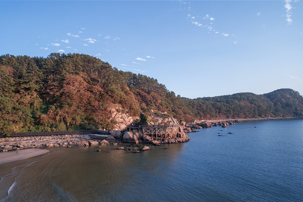
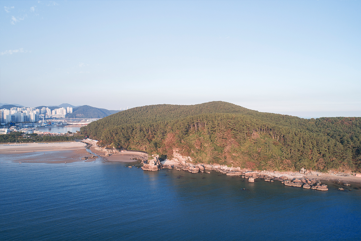
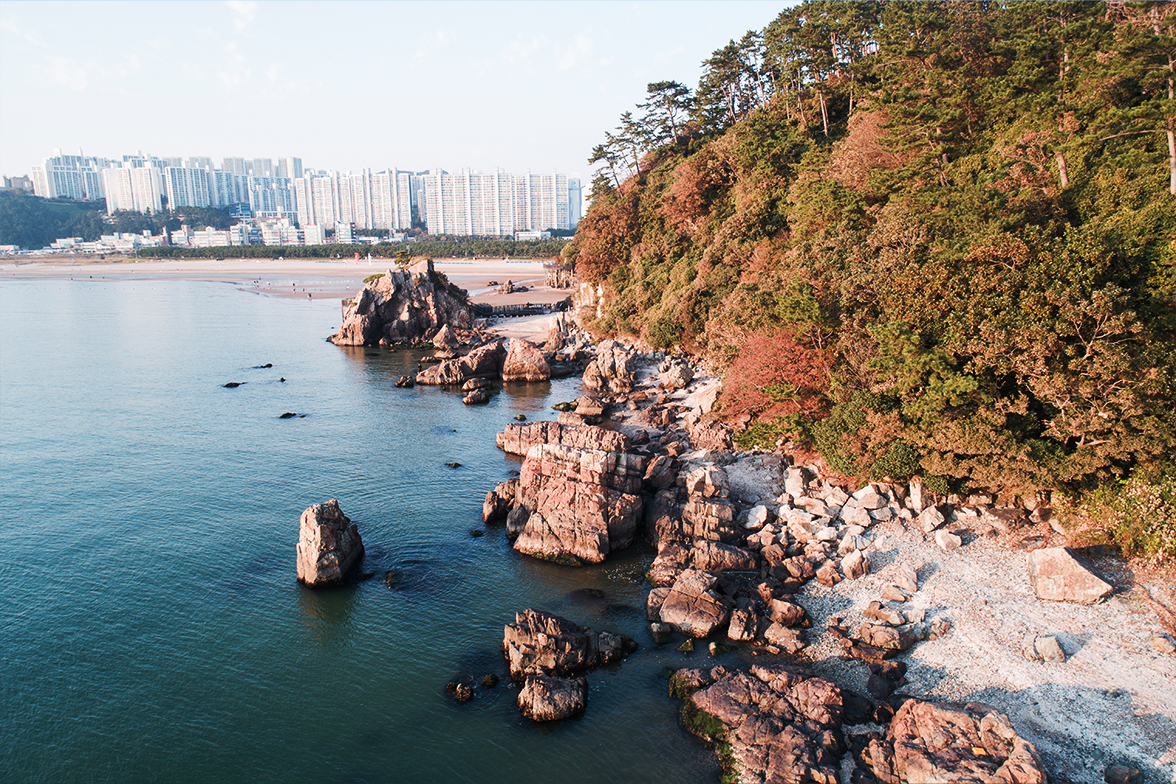
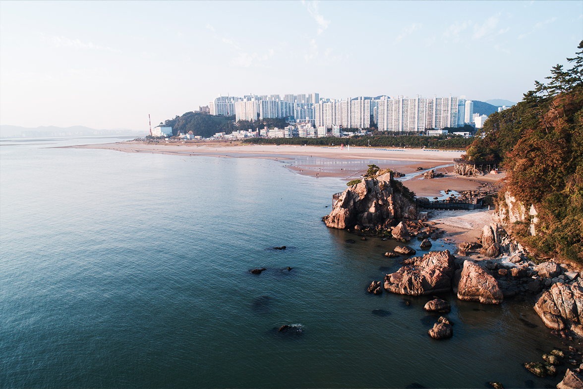
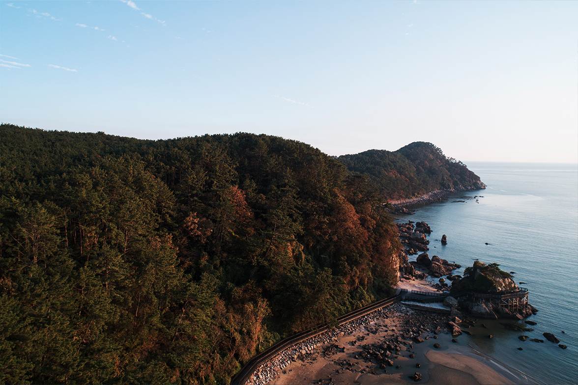
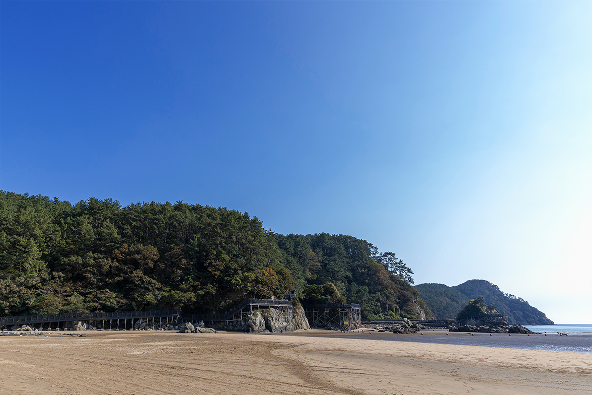
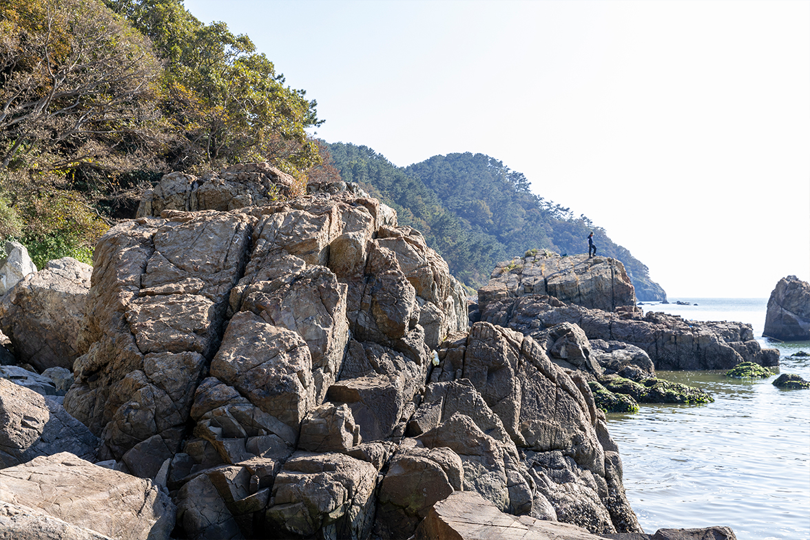
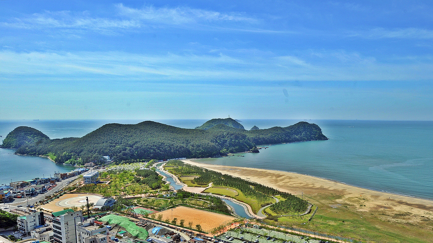
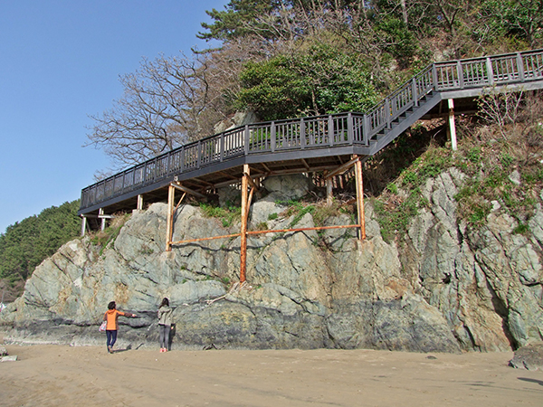
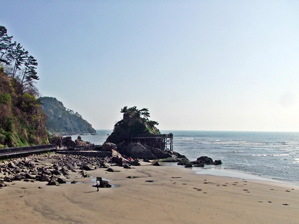
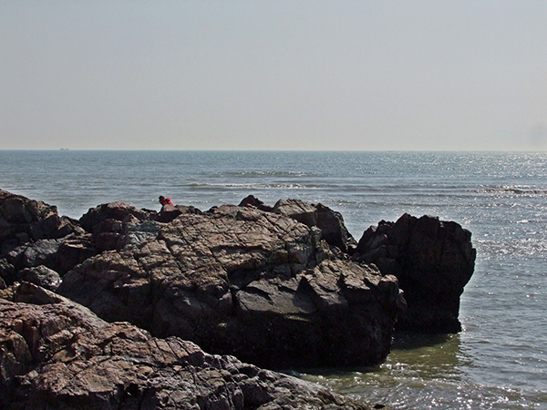
Morundae, located at the southernmost tip of Nakdonggang Estuary, is a typical land-tied island. It was an island called “Morundo”that was later connected to Dadaepo due to sedimentation from the upper reaches of the river. At the southern extremity of Morundae are sea cliffs and caves developed due to erosion by waves with a gorgeous sandy beach at the back used for sea bathing. Morundae is famous as an eminent scenic spot with dense groves, oddly shaped precipitous rocks, undulating sea waves and a beautiful sandy beach.
Its name, Morundae, originates from the fact that the area is covered due to air currents on foggy and cloudy days at Nakdonggang Estuary. The topography of Morundae is like the form of a flying crane whose beauty was praised from a distance by Dongnae Magistrate Lee Chunwon in his poem 『Records of Dongnae-bu(1740)』.
The natural scenic beauty of Morundae is highlighted by rugged precipices and trees on the sea side. Morundae is also well-known as a historic site where Nokdo Manho (naval officer) Jeong Un died while fighting in the vanguard of the Battle of Busan where Admiral Yi Sun-shin defeated 100 ones out of 500 Japanese ships, gaining a major victory during the Japanese Invasion of Korea in 1592.
Morundae is a renowned scenic site (Busan Metropolitan City Monument No. 27) located where Nakdonggang Estuary meets the sea. It was an island called “Morundo” that later took its land-tied island form after being connected with Dadaepo by sediment deposited from the upper reaches of the Nakdonggang River. Its poetic name “Morundae,” meaning island buried in clouds, was given because the island cannot be seen on foggy and cloudy days, as if buried in Nakdonggang Estuary. Morundae, close to Tsushima Island, was used as a main sea route for trading with Japan and was infested with Japanese pirates who engaged in plunder on the sea. It was the location of Admidral Yi Sun-shin’s vanguard during the Japanese Invasion of Korea in 1592.
Eurya japonica, an evergreen broad-leaved shrub belonging to tea family, grows at the foot of seaside mountains in the south area. Called “Ligustrum foliosum (Gasreginang in Korean)” on Jeju Island, from which its name Eurya japonica(Sasrepi in Korean) seems to originate. Its flowers smell like ammonia and have sterilizing and soothing effects. It is also said to help with air purification with great resistance to sulfurous acid gas.
Gomsol, an evergreen needleleaf tree, belonging to Pinaceae genus, usually grows on the seashore with some growing further inland along rivers. Golsol, meaning black pine tree, is also called Haesong(Antipathes japonica) because it grows along the seashore.
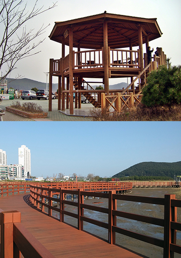
Noeuljeong pavilion, located at the starting point of the Morundae geological attraction of Busan National Geopark, has a trail leading to Nakdonggang Estuary Amisan Observatory. Further, at the Dadaepo Eco Experience Center, aquatic organisms including corbicula, littoral spoon clam, purple olive clam and sand-bubbler crab can be observed with migratory birds including black-tailed gull and small egret.
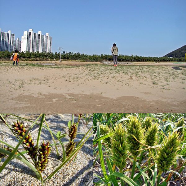
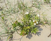
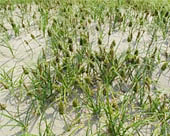
Sand dunes are hills resulting from sand transported from a river to the sandy beach by waves and littoral currents. In general, sand dunes are formed in parallel with the coastline, starting from an unnoticeable small scale up to a 500 meter giant scale. Further, on the sand dunes of Dadaepo Beach, dune plants including Asiatic sand sedge, Dwarf-sand sedge, beach peas and evening primrose can be observed.
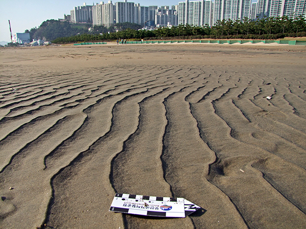
Ripple marks are formed on the earth by wind or water movements. When formed by wind or flowing water, ripple marks are in asymmetrical form and by waves, in symmetrical form. Check out the ripple marks on Dadaepo Beach
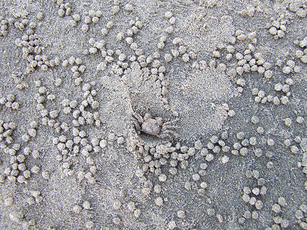
Purple olive clam, shellfish often observed on Dadaepo Beach mud flats, live in vertically- dug 10~20cm deep holes, 5mm in diameter. During the ebbing tides, they come out and transport sand with their mouth, using both pincers alternately to pick up feeds and spread out the remaining sand in pellet form around the holes. Observe these pellets.
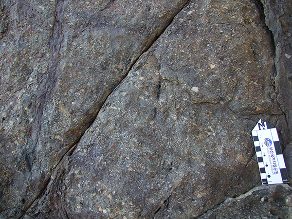
Because magma deep underground is lighter than the surrounding solid rock, it has a tendency to rise up. This rising magma interpenetrates along the bedding plane, a gap developed in sedimentary rocks. Such platy rock body parallel with the bedding plane is referred to as “sill.”
Dadaepo Beach is one of a few places in Korea for enjoying both sunrises and sunsets, in particular, the most striking sunsets. Appreciate the glorious sunset over the South Sea.
“Dadaepo Formation” of thick sedimentary layers comprised of red sandstone, siltstone and gray conglomerate was formed in the Dadaepo Basin about 8-70 million years ago. Dadaepo Formation is divided into Upper and Lower sections based on the features of its component rocks(presence of red layers and content of volcanic substances) and sedimentary environments. Here, conglomerate of Lower Dadaepo Formation can be seen.
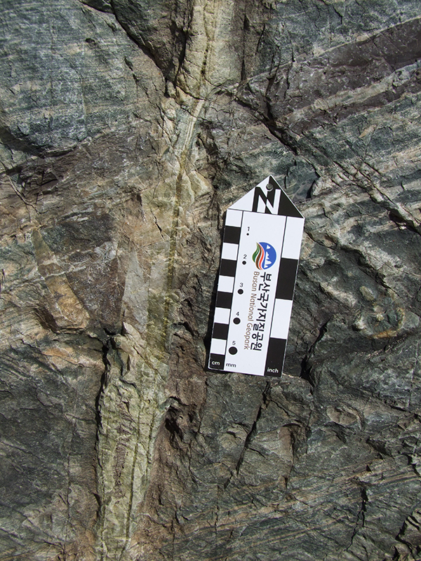
A fault where broken bedding of sedimentary layers is observed on the seashore of Morundae Geotrail. This fault shows the typical features of normal faults where the upper block of the fault plane has come down.

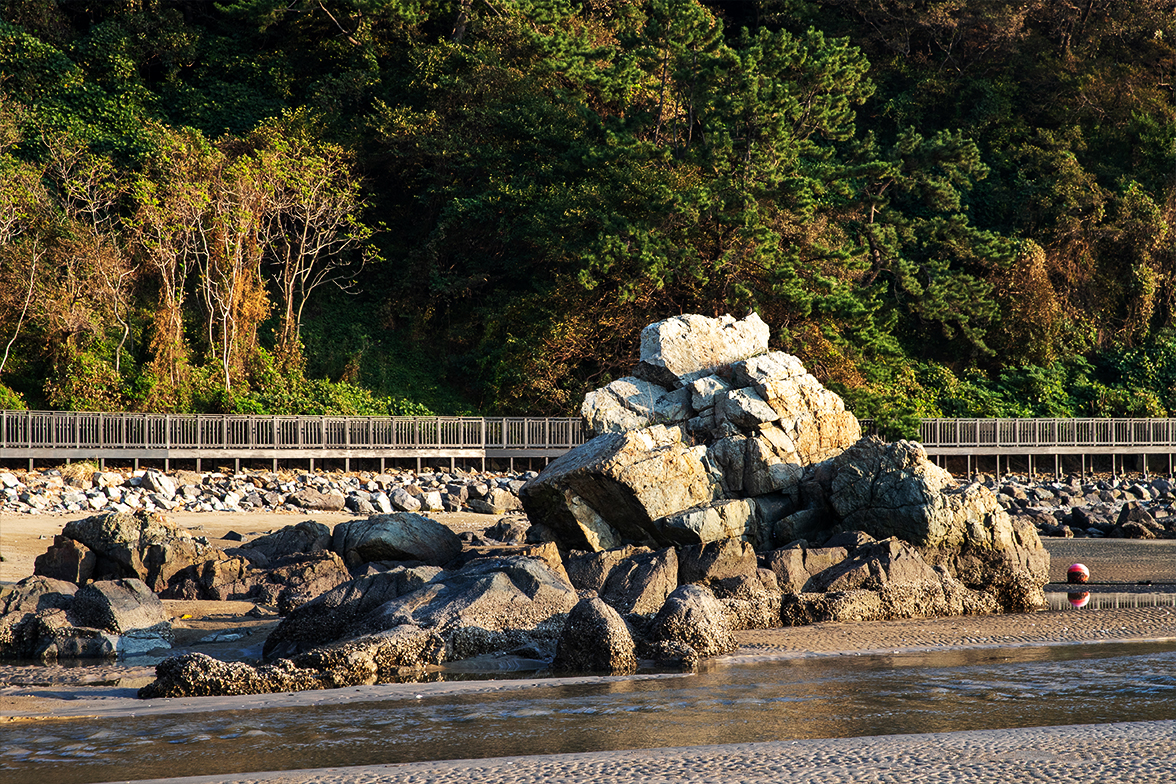
Walking along the Dadaepo-Morundae trail, you can find a rock shaped like a turtle raising its head in the sea. On this rock, called Turtle Rock, *joint sets developed in two systematic directions can be observed. *What are joints? Joints are cracks resulting from energy applied to rocks. Columnar joints formed by magma contraction while cooling is a typical example.
Veins are formed by precipitation of substances dissolved in hydrothermal solution into crystals when hydrothermal solution moves along cracks in rocks. The veins observed here show the compound vein form where small dark-greenish chlorite veins appear in quartz veins.

Morundae boasts exceptional scenery with oddly shaped rocks, dense Antipathes japonica forests and a beautiful sandy beach. The dazzling scene of sunset illuminating the fog is well known.
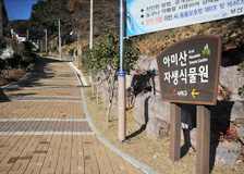
Amisan Botanic Garden, a large native botanical garden located at the foot of Amisan Mountain, Saha-gu, Busan, is an urban resting space with native plant communities, an eco-experience center, observation platform and rest areas.
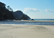
Dadaepo Beach created by sedimentation of soil of Nakdonggang River has an extensive sandy beach with gently flowing water that is safe for children to play in. In particular, Dadaepo Beach Park located by the beach, is a perfect place for strolls and picnics. Well equipped with a variety of amenities including shower rooms and parking lots, it is gaining the spotlight as a low-budget summer resort destination.